The History of St. Dominick – an occasional series: 1 – An Introduction
Thank you to 'The Who'd' for creating this Blog for St. Dominick - I am sure that it will be a mine of information over the years.
A bit of background: Those who know me (either as Ann Murphy or as my author name of Ann Foweraker: my maiden name) will know that I have had a lifelong interest in history, and in local and vernacular history in particular.
When we moved into Radland in1983 I was determined to find out the history of that old house – and that also led me into glimpses of the history of St. Dominick itself.
However, it was the inspiration of The Parish Map Project (a Common Ground initiative) that led me to work with about forty people within the parish (with many doing the research, artists creating the illustrations and others providing services, like photocopying) eventually to collate everything and to create a series of maps illustrating the history of the parish.

If you were not involved, a little about the Project. 'Parish Maps' could be created in any material, design, interest-focus or scope. We decided to take five snap-shots-in-time – and base most of them on existing maps. Many households in the parish have an A3 set, and there is a large-size A2 set hanging in the Parish Hall.
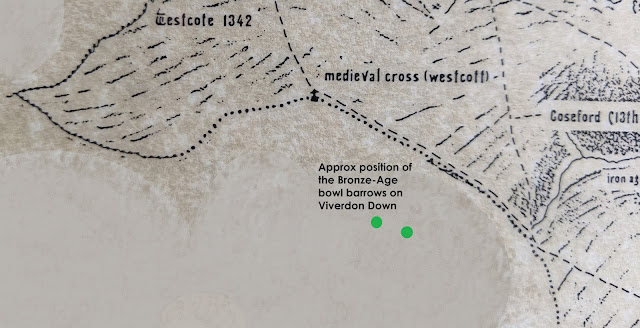
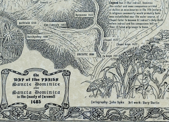
As there were no actual detailed maps of the area until the seventeen hundreds, the first map was dated at 1485 – showing everything we found from pre-history to that time. This date was chosen as it is also the start of the Tudor period. It is acknowledged that the relative stability of the Tudor period accelerated change in all parts of the country, making this point a good place to pause and look back.
The second map was dated 1748, and was based on an existing map you can view if you go to Lanhydrock, drawn by Thomas Martyn. To this was added the research that was gathered that focussed on properties that had been built and were still there between 1485 and the map’s date.
The third map is based on the Tithe Map 1841, probably the most detailed map made of the area – ever! A tithe map was made to commute tithes-in-kind (for example: one stook of wheat in every ten harvested) into a monetary value – so they could be paid that way instead. The original tithe map is huge! – and barely any of the fine detail could be shown on our maps, but the basic information and everything discovered was added to the original map.

The fourth map was based on the 1951 ordnance survey map – and shows how life had changed dramatically over the previous 110 years – and brings us firmly into history as remembered by people born in St. Dominick.
The final map was set at the year we completed the two-year project, 1995, and yet, even in the short time-period from the fifties, the changes are dramatic to see in terms of housing development and change of use for other buildings.
In this occasional series I hope to flesh-out the basics on the maps and share with you the research and the sources (where possible) and describe this area as it developed from just 'an area mainly bordered by streams and the river', into the parish we know today.
I do hope you’ll join me for the journey - Ann
Were you involved in our Parish Map Project?
How were you involved?
Do you remember the project?
Now, where did you put that set of maps ...?
Do comment below - we'd love to read your memories 😊
Comments
Post a Comment