History of St. Dominick – an occasional series: #4 Pre-history – 1485 Map 1: Part 3 Iron-Age
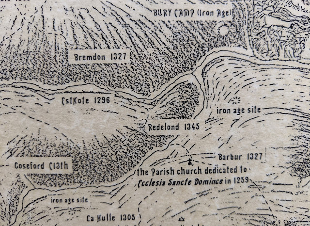
Part 3 Iron-Age The Iron Age (800 BC – AD 43) left more marks upon the landscape of the St. Dominick parish area. The most notable of these being at Berry Farm. Near the top of this section of map below - Bury Camp See section of map below: The change of name from ‘Bury Farm’ (with unrelated connotations as to its meaning - it is nothing to do with things or people being buried) to ‘Berry’ could be relatively recent – though it was written as Berry on the Tithe map (1841) it was still written as ‘Bury’ on the 1892 – 1914 OS map. Use the Reference (1) at the end of this post, to link into a side-by-side view showing the 1892 – 1914 Ordnance Survey map and an up-to-date satellite view. (you can copy and paste it into a separate window - or use control and click) A ‘Bury’ is the name given to a ditch and bank ‘fortification’ created during the Iron Age – and are sometime referred to as ‘rounds’ or ‘ camps ’ when of this smaller nature. The listing for the ‘Round a...